Checked
Brampton neighbourhoods: a guide to the main areas
Brampton, Ontario, Canada
The main areas of Brampton, Ontario and the City neighbourhood names inside them, with 2021 census population, housing types, GO and Züm transit, libraries, recreation centres and big parks.
Key information
Brampton had 656,480 people in the 2021 census. The City maps 53 named neighbourhoods, which this guide groups into eight main areas: downtown and central Brampton, Bramalea, Heart Lake and Snelgrove, Springdale, Castlemore and the Gore, Fletcher's Meadow and Mount Pleasant, Peel Village and south Brampton, and Credit Valley to Churchville. Springdale is the most populous area, Fletcher's Meadow and Mount Pleasant grew fastest, and Bramalea and downtown have most of the high-rise apartments.
On this page
Brampton areas at a glance
- Downtown and central Brampton97,724 people
- Bramalea90,454 people
- Heart Lake and Snelgrove50,404 people
- Springdale and north-central Brampton110,051 people
- Castlemore, the Gore and Bram East79,797 people
- Fletcher's Meadow and Mount Pleasant98,620 people
- Peel Village, County Court and south Brampton43,603 people
- Credit Valley, Springbrook and Churchville85,827 people
| Area | 2021 population | Change from 2016 | People per square km | Single-detached homes | Apartments 5+ storeys | Library branches |
|---|---|---|---|---|---|---|
| Downtown and central BramptonMap of Downtown and central Brampton | 97,724 | +3.0% | 4,636 | 36% | 20% | Four Corners |
| BramaleaMap of Bramalea | 90,454 | +2.5% | 2,200 | 39% | 27% | Chinguacousy |
| Heart Lake and SnelgroveMap of Heart Lake and Snelgrove | 50,404 | +2.9% | 2,735 | 66% | 0% | Cyril Clark |
| Springdale and north-central BramptonMap of Springdale and north-central Brampton | 110,051 | +13.1% | 3,849 | 57% | 0% | Springdale |
| Castlemore, the Gore and Bram EastMap of Castlemore, the Gore and Bram East | 79,797 | +2.8% | 1,327 | 66% | 3% | Gore Meadows; Claireville |
| Fletcher's Meadow and Mount PleasantMap of Fletcher's Meadow and Mount Pleasant | 98,620 | +31.2% | 3,084 | 64% | 1% | Mount Pleasant Village |
| Peel Village, County Court and south BramptonMap of Peel Village, County Court and south Brampton | 43,603 | +3.1% | 2,322 | 42% | 21% | South Fletcher's |
| Credit Valley, Springbrook and ChurchvilleMap of Credit Valley, Springbrook and Churchville | 85,827 | +24.2% | 1,874 | 63% | 1% | South West |
Brampton grew from 593,638 people in 2016 to 656,480 in 2021, up 10.6%. The table splits that total into eight areas. Figures are calculated: each 2021 census tract is placed in the area where its centre falls (or the nearest area, for 10 tracts in industrial or rural gaps), then tract totals are added. Housing shares are of occupied private dwellings.
Sources: City of Brampton GeoHub 2021 Census population and dwellings by census tract · City of Brampton GeoHub 2021 Census dwelling types by census tract · City of Brampton GeoHub neighbourhood boundary areas (Nurturing Neighbourhoods Program)
How the City divides Brampton
Brampton has no single official list of neighbourhoods for every purpose. Three City maps are useful:
Neighbourhoods: for its Nurturing Neighbourhoods Program, the City mapped 53 named neighbourhoods, such as Madoc, Professors Lake, Sandalwood East (Mountainash) and Churchville. The map says boundaries and names may change. This guide uses those names and groups them into eight areas.
Secondary plans: the Official Plan sets out secondary plan areas, such as 3 (Bramalea), 2 (Springdale) and 51 (Mount Pleasant), with more detailed rules on land use, design, roads and parks. The Brampton Plan map layer has 40 secondary plan area shapes.
Wards: Brampton elects 10 ward councillors. A 2024 ward boundary review kept the 10-ward model and looked at new boundaries for the 2026 election, so check the City ward map for your current ward.
Sources: Nurturing Neighbourhoods Program neighbourhood boundaries map 2022-2023 (PDF) | City of Brampton · City of Brampton GeoHub neighbourhood boundary areas (Nurturing Neighbourhoods Program) · Secondary plans | City of Brampton · Brampton Plan Schedule 10 secondary plan areas | City of Brampton GeoHub · Ward Boundary Review: update and boundary realignment options (PDF) | City of Brampton
The eight main areas
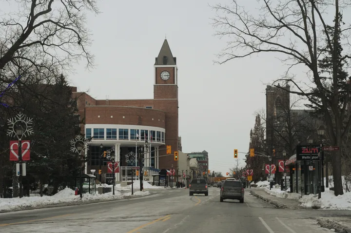
Downtown and central Brampton
65 Queen Street East
The downtown core along Main Street and Queen Street, with Gage Park, the Four Corners library and the Brampton GO station, plus the neighbourhoods around it.
City neighbourhoods in this area: Downtown, Centre, Madoc, Lakelands Village, Royal Orchard, Northwood Park, Ridgehill / Armbro Heights.
About 97,724 people lived here in 2021, up 3.0% from 2016. Homes were 36% single-detached houses, 20% apartments of 5 or more storeys, 13% semi-detached houses, 13% row houses, 11% apartments under 5 storeys, 6% duplex units.
Transit: Brampton GO station (Kitchener line). Züm Queen Street starts at the Downtown Terminal, and Züm Queen Street West runs from there to Mount Pleasant GO.
The Main Street South area, from Wellington Street toward Etobicoke Creek, has a draft Heritage Conservation District Plan that the City lists as in progress.
- 2021 population (calculated)
- 97,724
- Change since 2016
- +3.0%
- Land area of census tracts
- 21.1 square km
- People per square km
- 4,636
- Library branches
- Four Corners
- Recreation centres
- Century Gardens Recreation Centre; Chris Gibson Recreation Centre; Central Public School Recreation and Arts Centre; Memorial Arena; Kiwanis Youth Centre for Sports Excellence
- Large parks
- Chris Gibson Park (18.8 ha, off-leash area and splash pad); Centennial Park (16.6 ha); Duggan Park (9.1 ha, off-leash area and outdoor rink); Gage Park (skating trail and splash pad)
- Secondary plan areas
- 7: Downtown Brampton; 6: Brampton Flowertown (part); 55: Hurontario-Main Corridor; 36: Queen Street Corridor (part)
Map point is a landmark in the area, not its centre or boundary.
Sources: City of Brampton GeoHub neighbourhood boundary areas (Nurturing Neighbourhoods Program) · City of Brampton GeoHub 2021 Census population and dwellings by census tract · City of Brampton GeoHub 2021 Census dwelling types by census tract · City of Brampton GeoHub Recreation Centres layer · Brampton Library branches · City of Brampton GeoHub Parks layer · Brampton Plan Schedule 10 secondary plan areas | City of Brampton GeoHub
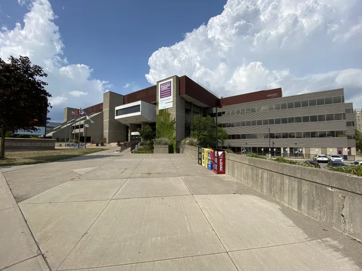
Bramalea
9050 Bramalea Road
East-central Brampton. The City still uses Bramalea's lettered sections as neighbourhood names, and the area has the highest share of high-rise apartments in this guide.
City neighbourhoods in this area: A-B-C-D Section, E-F-K Section, G Section, H Section, M Section, N Section, Bramalea Woods, Norton Park, Professors Lake.
About 90,454 people lived here in 2021, up 2.5% from 2016. Homes were 39% single-detached houses, 27% apartments of 5 or more storeys, 12% row houses, 11% semi-detached houses, 6% apartments under 5 storeys, 5% duplex units.
Transit: Bramalea GO station at 1713 Steeles Avenue East. Züm Queen Street runs through the area, with planned station areas at Dixie, Bramalea and Central Park (Bramalea Terminal).
- 2021 population (calculated)
- 90,454
- Change since 2016
- +2.5%
- Land area of census tracts
- 41.1 square km
- People per square km
- 2,200
- Library branches
- Chinguacousy (in the Chinguacousy Park Ski Chalet)
- Recreation centres
- Balmoral Recreation Centre; Earnscliffe Recreation Centre; Ellen Mitchell Recreation Centre; Greenbriar Recreation Centre; Howden Recreation Centre; Terry Miller Recreation Centre; Professor's Lake Recreation Centre; Norton Place Park Community Centre; Knightsbridge Community and Senior Citizens Centre
- Large parks
- Chinguacousy Park (40.1 ha, skating trail, splash pad, ski chalet, curling and tennis centre); Professors Lake Park (37.7 ha); Emancipation Park (40.0 ha); Bramalea Ltd Community Park (15.5 ha, off-leash area)
- Secondary plan areas
- 3: Bramalea; 36: Queen Street Corridor (part); 5: Highway 410 and Steeles (part)
Map point is a landmark in the area, not its centre or boundary.
Sources: City of Brampton GeoHub neighbourhood boundary areas (Nurturing Neighbourhoods Program) · City of Brampton GeoHub 2021 Census population and dwellings by census tract · City of Brampton GeoHub 2021 Census dwelling types by census tract · City of Brampton GeoHub Recreation Centres layer · Brampton Library branches · City of Brampton GeoHub Parks layer · Brampton Plan Schedule 10 secondary plan areas | City of Brampton GeoHub
Heart Lake and Snelgrove
30 Loafers Lake Lane
North-central Brampton, including the Heart Lake conservation lands. Two in three homes are single-detached houses and there are almost no high-rise apartments.
City neighbourhoods in this area: Heart Lake North, Heart Lake South, Snelgrove, Van Kirk.
About 50,404 people lived here in 2021, up 2.9% from 2016. Homes were 66% single-detached houses, 13% row houses, 11% semi-detached houses, 7% duplex units.
Transit: No GO station. Local Brampton Transit routes; Züm Main Street runs north as far as Sandalwood Parkway.
- 2021 population (calculated)
- 50,404
- Change since 2016
- +2.9%
- Land area of census tracts
- 18.4 square km
- People per square km
- 2,735
- Library branches
- Cyril Clark
- Recreation centres
- Paul Palleschi Recreation Centre (listed as Loafer's Lake Recreation Centre in City data); Jim Archdekin Recreation Centre; Snelgrove Community Centre
- Large parks
- White Spruce Park (22.7 ha, off-leash area); Paul Palleschi Park (16.6 ha, splash pad); Richvale Park (12.2 ha); Morris Kerbel Park (11.3 ha, skate park); Camden Park East (off-leash area)
- Secondary plan areas
- 1: Snelgrove-Heart Lake; HLC: Heart Lake (conservation lands)
Map point is a landmark in the area, not its centre or boundary.
Sources: City of Brampton GeoHub neighbourhood boundary areas (Nurturing Neighbourhoods Program) · City of Brampton GeoHub 2021 Census population and dwellings by census tract · City of Brampton GeoHub 2021 Census dwelling types by census tract · City of Brampton GeoHub Recreation Centres layer · Brampton Library branches · City of Brampton GeoHub Parks layer · Brampton Plan Schedule 10 secondary plan areas | City of Brampton GeoHub
Springdale and north-central Brampton
10705 Bramalea Road
The most populous area in this guide, in north-central and northeast Brampton. Homes are mostly detached and semi-detached houses, and the population grew about 13% from 2016 to 2021.
City neighbourhoods in this area: Springdale, Sandalwood West (Sunny Meadow), Sandalwood East (Mountainash), Deerfield, Trinity Commons, Rosedale Village, Countryside, Mount Royal, Wildfield.
About 110,051 people lived here in 2021, up 13.1% from 2016. Homes were 57% single-detached houses, 17% semi-detached houses, 15% row houses, 8% duplex units.
Transit: No GO station. Served by local Brampton Transit routes; Züm Main Street runs north to Sandalwood Parkway.
- 2021 population (calculated)
- 110,051
- Change since 2016
- +13.1%
- Land area of census tracts
- 28.6 square km
- People per square km
- 3,849
- Library branches
- Springdale
- Recreation centres
- Brampton Soccer Centre; Chinguacousy Wellness Centre
- Large parks
- Sesquicentennial Park (39.0 ha, splash pad and outdoor rink); Torbram Sandalwood Community Park (13.1 ha); Batsman Park (12.2 ha, splash pad, cricket); Dixie Sandalwood Park (11.7 ha); Komagata Maru Park (splash pad)
- Secondary plan areas
- 2: Springdale; 48 (a) and 48 (b): Countryside Villages
Map point is a landmark in the area, not its centre or boundary.
Sources: City of Brampton GeoHub neighbourhood boundary areas (Nurturing Neighbourhoods Program) · City of Brampton GeoHub 2021 Census population and dwellings by census tract · City of Brampton GeoHub 2021 Census dwelling types by census tract · City of Brampton GeoHub Recreation Centres layer · Brampton Library branches · City of Brampton GeoHub Parks layer · Brampton Plan Schedule 10 secondary plan areas | City of Brampton GeoHub
Castlemore, the Gore and Bram East
10150 The Gore Road
Northeast Brampton. It has the lowest population density in this guide because it also takes in the Toronto Gore Rural Estate, Clairville Conservation and Highway 427 Industrial secondary plan areas.
City neighbourhoods in this area: Castlemore Estates, Vales of Castlemore, Rivers Edge / Castlemore Crossing, Valley Creek, Ebenezer East, Ebenezer West.
About 79,797 people lived here in 2021, up 2.8% from 2016. Homes were 66% single-detached houses, 19% semi-detached houses, 6% row houses, 6% duplex units.
Transit: No GO station. Züm Queen Street continues east from downtown to York University.
- 2021 population (calculated)
- 79,797
- Change since 2016
- +2.8%
- Land area of census tracts
- 60.1 square km
- People per square km
- 1,327
- Library branches
- Gore Meadows; Claireville (8750 The Gore Road)
- Recreation centres
- Gore Meadows Community Centre (covered outdoor rink); Ebenezer Community Centre; Gore Bocce Club
- Large parks
- Gore Meadows Community Park East (48.7 ha, splash pad, skate park, cricket); Ezard Park (3.7 ha)
- Secondary plan areas
- 41: Bram East; 42: Vales of Castlemore; 49: Vales of Castlemore North; 50: Vales of Humber; 26: Toronto Gore Rural Estate; 47: Highway 427 Industrial; CC: Clairville Conservation
Map point is a landmark in the area, not its centre or boundary.
Sources: City of Brampton GeoHub neighbourhood boundary areas (Nurturing Neighbourhoods Program) · City of Brampton GeoHub 2021 Census population and dwellings by census tract · City of Brampton GeoHub 2021 Census dwelling types by census tract · City of Brampton GeoHub Recreation Centres layer · Brampton Library branches · City of Brampton GeoHub Parks layer · Brampton Plan Schedule 10 secondary plan areas | City of Brampton GeoHub
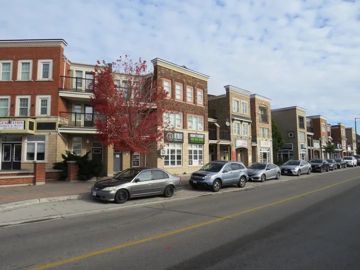
Fletcher's Meadow and Mount Pleasant
100 Commuter Drive
Northwest Brampton. It grew faster than any other area here between 2016 and 2021. Mount Pleasant Village Community Centre, its library branch and an outdoor rink share 100 Commuter Drive.
City neighbourhoods in this area: Fletcher's Meadow North, Fletcher's Meadow South, Mount Pleasant North, Mount Pleasant Village, Creditview, Alloa, Fletcher's Creek Village / Lundy Village.
About 98,620 people lived here in 2021, up 31.2% from 2016. Homes were 64% single-detached houses, 16% semi-detached houses, 15% row houses.
Transit: Mount Pleasant GO station (Kitchener line). Züm Bovaird Drive and Züm Queen Street West both start at Mount Pleasant GO.
West of Mississauga Road, Heritage Heights (secondary plan areas 52 and 53) is the last undeveloped part of Brampton. The City plans a new town centre there.
- 2021 population (calculated)
- 98,620
- Change since 2016
- +31.2%
- Land area of census tracts
- 32.0 square km
- People per square km
- 3,084
- Library branches
- Mount Pleasant Village
- Recreation centres
- Cassie Campbell Community Centre; Mount Pleasant Village Community Centre (outdoor rink)
- Large parks
- Creditview Sandalwood Park (65.0 ha, the largest park in the City data, splash pad, cricket); Chinguacousy Sandalwood Community Park (11.2 ha); Jim Irons Park (splash pad); Ahmadiyya Park (splash pad, skate park)
- Secondary plan areas
- 44: Fletcher's Meadow; 51: Mount Pleasant; 43: Fletcher's Creek Village; 2(a): Northwest Sandalwood Parkway
Map point is a landmark in the area, not its centre or boundary.
Sources: City of Brampton GeoHub neighbourhood boundary areas (Nurturing Neighbourhoods Program) · City of Brampton GeoHub 2021 Census population and dwellings by census tract · City of Brampton GeoHub 2021 Census dwelling types by census tract · City of Brampton GeoHub Recreation Centres layer · Brampton Library branches · City of Brampton GeoHub Parks layer · Brampton Plan Schedule 10 secondary plan areas | City of Brampton GeoHub
Peel Village, County Court and south Brampton
370 Bartley Bull Parkway
South-central Brampton. It has a larger share of duplex units and high-rise apartments than most areas, and its population grew about 3% from 2016 to 2021.
City neighbourhoods in this area: Peel Village, County Court, Sheridan, Hickory Woods.
About 43,603 people lived here in 2021, up 3.1% from 2016. Homes were 42% single-detached houses, 21% apartments of 5 or more storeys, 17% duplex units, 11% row houses, 8% apartments under 5 storeys.
Transit: No GO station inside the area; the nearest is Bramalea GO at 1713 Steeles Avenue East. Züm Steeles Avenue runs between Lisgar GO and Humber College.
- 2021 population (calculated)
- 43,603
- Change since 2016
- +3.1%
- Land area of census tracts
- 18.8 square km
- People per square km
- 2,322
- Library branches
- South Fletcher's (500 Ray Lawson Boulevard)
- Recreation centres
- Ken Giles Recreation Centre; South Fletcher's Sportsplex; County Court Fieldhouse; Peel Village Golf Course
- Large parks
- Brampton Sports Park (45.4 ha, cricket and kabaddi); Peel Village Golf Course (31.4 ha); Fletchers Green Community Park (9.3 ha, off-leash area); Peel Village Park (splash pad, outdoor rink)
- Secondary plan areas
- 24: Fletcher's Creek South; 5: Highway 410 and Steeles (part); 54: Kennedy Road South
Map point is a landmark in the area, not its centre or boundary.
Sources: City of Brampton GeoHub neighbourhood boundary areas (Nurturing Neighbourhoods Program) · City of Brampton GeoHub 2021 Census population and dwellings by census tract · City of Brampton GeoHub 2021 Census dwelling types by census tract · City of Brampton GeoHub Recreation Centres layer · Brampton Library branches · City of Brampton GeoHub Parks layer · Brampton Plan Schedule 10 secondary plan areas | City of Brampton GeoHub
Credit Valley, Springbrook and Churchville
8870 McLaughlin Road South
Southwest Brampton. It grew by about a quarter between 2016 and 2021 and has the second-largest land area in this guide, after the northeast. Churchville is a protected heritage village.
City neighbourhoods in this area: Credit Valley, Spring Valley, Huttonville, Springbrook, New Springbrook, Churchville, Fletcher's West.
About 85,827 people lived here in 2021, up 24.2% from 2016. Homes were 63% single-detached houses, 14% semi-detached houses, 14% row houses, 7% duplex units.
Transit: No GO station. Züm Steeles Avenue (Lisgar GO to Humber College) serves Steeles Avenue.
Churchville has been a Heritage Conservation District since City Council adopted By-law 219-1990 on October 10, 1990.
- 2021 population (calculated)
- 85,827
- Change since 2016
- +24.2%
- Land area of census tracts
- 45.8 square km
- People per square km
- 1,874
- Library branches
- South West (8405 Financial Drive)
- Recreation centres
- Huttonville Community Centre; Flower City Community Campus (seniors centre and lawn bowling); Eldorado Park outdoor pool
- Large parks
- Flower City Community Campus (32.9 ha, outdoor rink); Eldorado Park (21.7 ha); Teramoto Park (16.4 ha, splash pad); Andrew McCandless Park (15.7 ha, splash pad, skate park)
- Secondary plan areas
- 12: Credit Valley; 40 (a) to 40 (d): Bram West; 29: Huttonville; 6: Brampton Flowertown (part)
Map point is a landmark in the area, not its centre or boundary.
Sources: City of Brampton GeoHub neighbourhood boundary areas (Nurturing Neighbourhoods Program) · City of Brampton GeoHub 2021 Census population and dwellings by census tract · City of Brampton GeoHub 2021 Census dwelling types by census tract · City of Brampton GeoHub Recreation Centres layer · Brampton Library branches · City of Brampton GeoHub Parks layer · Brampton Plan Schedule 10 secondary plan areas | City of Brampton GeoHub
Area groupings are this guide's, built from the City neighbourhood boundary names. Population and housing figures are calculated from City-published 2021 census tract data and are approximate at area edges.
Sources: City of Brampton GeoHub neighbourhood boundary areas (Nurturing Neighbourhoods Program) · City of Brampton GeoHub 2021 Census population and dwellings by census tract · City of Brampton GeoHub 2021 Census dwelling types by census tract · City of Brampton GeoHub Recreation Centres layer · Brampton Library branches · City of Brampton GeoHub Parks layer
Getting around: GO trains and Züm
Brampton has three GO stations on the Kitchener line: Bramalea GO at 1713 Steeles Avenue East, Brampton GO downtown and Mount Pleasant GO in the northwest.
Brampton Transit runs 70 routes, including five Züm rapid bus lines with limited stops: Queen Street (Downtown Terminal to York University), Main Street (Sandalwood Parkway to Mississauga City Centre), Steeles Avenue (Lisgar GO to Humber College), Bovaird Drive (Mount Pleasant GO to Malton GO) and Queen Street West (Downtown Terminal to Mount Pleasant GO). Route 501 Züm Queen is the busiest.
Sources: Bramalea GO station | GO Transit · Brampton Plan Schedule 1B major transit station areas | City of Brampton GeoHub · Züm bus rapid transit | City of Brampton · Brampton Transit: our system | City of Brampton
Where Brampton is growing, and its heritage districts
Heritage Heights, secondary plan areas 52 (Huttonville North) and 53 (Mount Pleasant West), is Brampton's last undeveloped area. It runs from Mayfield Road to the Credit River valley, between Winston Churchill Boulevard and Mississauga Road, and covers about one-sixteenth of the city's land. The Ontario Land Tribunal has approved its secondary plan, and the City plans a new mixed-use town centre there.
Churchville is a designated Heritage Conservation District under By-law 219-1990, adopted in 1990. The City lists a Main Street South Heritage Conservation District Plan for part of downtown as in progress.
Sources: Heritage Heights | City of Brampton · Churchville Heritage Conservation District Plan (PDF) | City of Brampton · Main Street South Heritage Conservation District | City of Brampton
Schools, libraries and recreation by area
Brampton Library has nine branches; each area section above lists the ones inside it. Bramalea has the most City recreation centres in the City recreation layer. For schools, check your exact address with the school boards; the school registration guide explains how.
Sources: Brampton Library branches · City of Brampton GeoHub Recreation Centres layer
Questions about Brampton neighbourhoods
How many neighbourhoods are there in Brampton?
The City mapped 53 named neighbourhoods for its Nurturing Neighbourhoods Program, from Wildfield in the north to Churchville in the south. The City notes that the boundaries and names may change.
Source: Nurturing Neighbourhoods Program neighbourhood boundaries map 2022-2023 (PDF) | City of Brampton
What was the population of Brampton in 2021?
656,480 people, up from 593,638 in 2016, according to the 2021 census tract data the City publishes.
Source: City of Brampton GeoHub 2021 Census population and dwellings by census tract
Which part of Brampton grew fastest?
Fletcher's Meadow and Mount Pleasant in the northwest, up about 31.2% from 2016 to 2021 by this guide's calculation from census tracts. Credit Valley to Churchville grew about 24.2%.
Source: City of Brampton GeoHub 2021 Census population and dwellings by census tract
Where are the apartment buildings in Brampton?
Mostly in Bramalea, where 27% of homes were in buildings of 5 or more storeys in 2021, and in downtown and south Brampton (20% and 21%). Heart Lake, Springdale and the northwest had almost none.
Source: City of Brampton GeoHub 2021 Census dwelling types by census tract
What are the lettered sections of Bramalea?
The City neighbourhood map names Bramalea areas by letter: A-B-C-D Section, E-F-K Section, G Section, H Section, M Section and N Section, plus Bramalea Woods, Norton Park and Professors Lake.
Source: City of Brampton GeoHub neighbourhood boundary areas (Nurturing Neighbourhoods Program)
Which GO stations are in Brampton?
Bramalea GO (1713 Steeles Avenue East), Brampton GO downtown and Mount Pleasant GO in the northwest, all on the Kitchener line.
Source: Brampton Plan Schedule 1B major transit station areas | City of Brampton GeoHub
Where will Brampton build next?
Heritage Heights in the northwest, west of Mississauga Road. It is Brampton's last undeveloped area and about one-sixteenth of its land. Its secondary plan was approved by the Ontario Land Tribunal.
Does Brampton have heritage districts?
Churchville has been a Heritage Conservation District since 1990 under By-law 219-1990. A Main Street South district plan downtown is listed as in progress.
Source: Churchville Heritage Conservation District Plan (PDF) | City of Brampton
How many wards does Brampton have?
10 wards, each with a City councillor. The 2024 ward boundary review kept the 10-ward model and looked at new boundaries for the 2026 election.
Source: Ward Boundary Review: update and boundary realignment options (PDF) | City of Brampton
Which Züm route serves Mount Pleasant?
Two do: Züm Bovaird Drive (Mount Pleasant GO to Malton GO) and Züm Queen Street West (Downtown Terminal to Mount Pleasant GO).